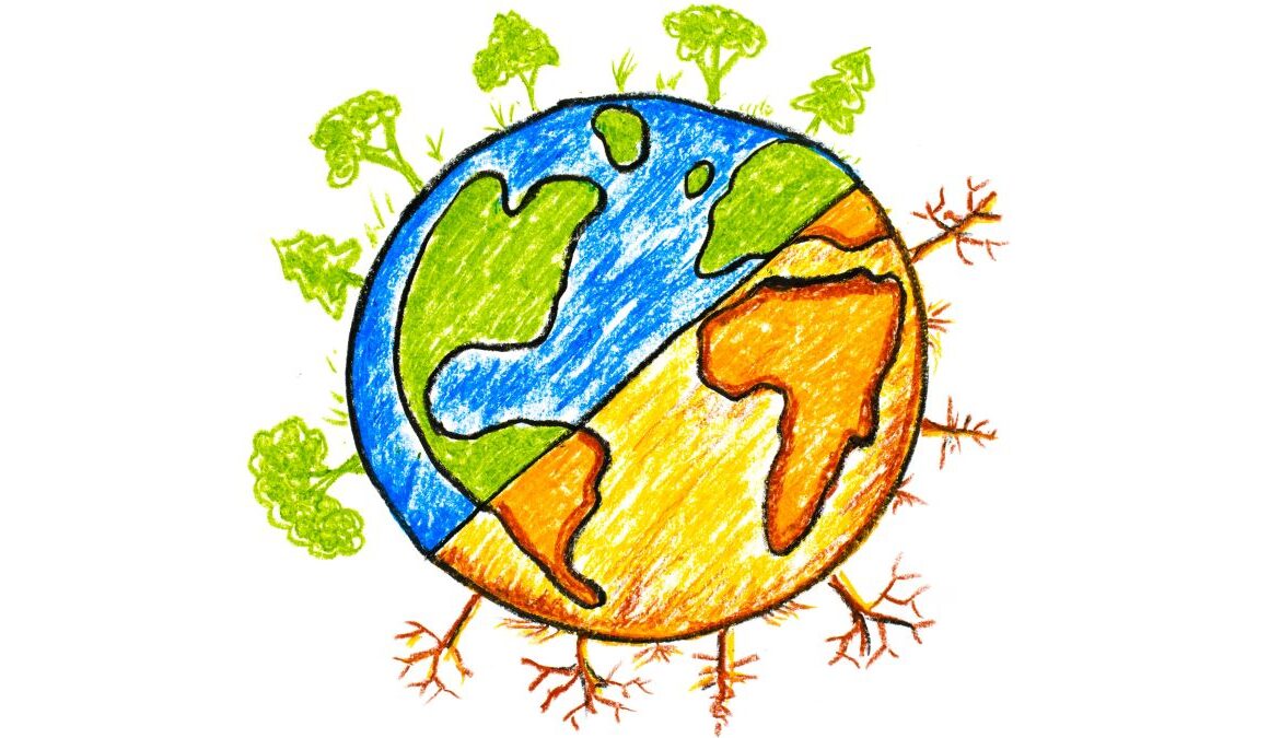
People who eat or drink more foods with antioxidant flavonols, which are found in several fruits and vegetables as well as tea and wine, may have a slower rate of memory decline, according to a new study.
Source link
As the international Surface Water and Ocean Topography (SWOT) mission finishes final preparations for its December launch, a new video series focuses on some of the engineers and scientists behind the satellite, which will be the first to observe nearly all water on Earth’s surface.
Led by NASA and the French space agency Centre National d’Études Spatiales (CNES), SWOT will measure the height of water in lakes, rivers, reservoirs, and the ocean. The SUV-size satellite will improve scientists’ ability to track the movement of water around the world while providing data that will help communities monitor and plan for changing water resources.
Get NASA’s Climate Change News
In addition, the mission will boost scientists’ understanding of how sea level rise will affect coastlines around the world and the people who live near them. SWOT will also see ocean features too small for current space-based instruments to detect, improving researchers’ understanding of their role in climate change.
More than a machine, SWOT is the culmination of years of work by a global team of engineers, scientists, and technicians committed to improving our understanding of our home planet. In this video series, you can meet team members from NASA’s Jet Propulsion Laboratory in Southern California, which manages the U.S. portion of the mission, and from the agency’s headquarters in Washington as they explain why working on SWOT means so much to them:
- Cedric David, a hydrologist who studies the world’s rivers, shares how water is the only place he feels truly comfortable because of physical challenges. As Cedric notes, SWOT will provide a global picture of freshwater resources and help improve water management, which is why he is so proud to help make a difference in protecting this precious resource.
- Christine Gebara, a mechanical engineer who helped test and integrate the spacecraft, tells the story of how she fell in love with engineering while learning to sail with the Girl Scouts on a lake near her childhood home in Houston. She reveals what inspires her most about building a spacecraft and offers advice for young women interested in engineering.
- Tahani Amer, the mission’s program executive, recalls growing up near Cairo, where her father encouraged her to study math and science – an atypical pursuit for young women in Egypt at the time. Today, she oversees several NASA Earth science missions, including SWOT. In the video, Amer shares how she’s been inspired by her Islamic faith, her family, and her colleagues.
- Marc Simard, a scientist who studies river deltas where they meet the ocean, discusses how he developed a passion for the environment in college, switching from a planned career in astrophysics to developing tools to study Earth. One of Simard’s favorite things about SWOT is that its data will help scientists better understand how sea level rise will affect coastal deltas around the world.
The full video series can be viewed here.
Watch a Q&A session with Tahani Amer on JPL’s Instagram account on Nov. 30. There will also be live chats on Instagram with Cedric David on Dec. 7, Christine Gebara on Dec. 14, and Marc Simard on Jan. 11. All three live chats will take place at noon PST, and questions can be submitted during the chats in the comments section or with the hashtag #AskNASA.
SWOT is scheduled to launch from Vandenberg Space Force Base in central California Dec. 12. NASA’s Launch Services Program, based at the agency’s Kennedy Space Center in Florida, is managing the launch service.
Updates about the satellite’s progress toward launch can be found at:
More About the Mission
SWOT is being jointly developed by NASA and CNES, with contributions from the CSA and the UK Space Agency. JPL, which is managed for NASA by Caltech in Pasadena, California, leads the U.S. component of the project. For the flight system payload, NASA is providing the Ka-band Radar Interferometer (KaRIn) instrument, a GPS science receiver, a laser retroreflector, a two-beam microwave radiometer, and NASA instrument operations.
CNES is providing the Doppler Orbitography and Radioposition Integrated by Satellite (DORIS) system, the dual frequency Poseidon altimeter (developed by Thales Alenia Space), the KaRIn radio-frequency subsystem (together with Thales Alenia Space and with support from the UK Space Agency), the satellite platform, and ground control segment. CSA is providing the KaRIn high-power transmitter assembly. NASA is providing the launch vehicle and associated launch services.
To learn more about SWOT, visit:
Additional resources:
News Media Contacts
Jane J. Lee / Andrew Wang
Jet Propulsion Laboratory, Pasadena, Calif.
818-354-0307 / 626-379-6874
[email protected] / [email protected]
The warming during the summer months in Europe has been much faster than the global average, shows a new study by researchers at Stockholm University published in the Journal of Geophysical Research Atmospheres. As a consequence of human emissions of greenhouse gases, the climate across the continent has also become drier, particularly in southern Europe, leading to worse heat waves and an increased risk of fires.
According to the UN’s Intergovernmental Panel on Climate Change (IPCC), warming over land areas occurs significantly faster than over oceans, with 1.6 degrees and 0.9 degrees on average, respectively. It means that the global greenhouse gas emissions budget to stay under a 1.5-degree warming on land has already been used up. Now, the new study shows that the emissions budget to avoid a 2-degree warming over large parts of Europe during the summer half-year (April-September) has also been used up. In fact, measurements reveal that the warming during the summer months in large parts of Europe during the last four decades has already surpassed two degrees.
“Climate change is serious as it leads to, among other things, more frequent heat waves in Europe. These, in turn, increase the risk of fires, such as the devastating fires in southern Europe in the summer of 2022,” says Paul Glantz, Associate Professor at the Department of Environmental Science, Stockholm University, and main author of the study.
In southern Europe, a clear, so-called, positive feedback caused by global warming is evident, i.e. warming is amplified due to drier soil and decreased evaporation. Moreover, there has been less cloud coverage over large parts of Europe, probably as a result of less water vapour in the air.
“What we see in southern Europe is in line what IPCC has predicted, which is that an increased human impact on the greenhouse effect would lead to dry areas on Earth becoming even drier,” says Paul Glantz.
Impact of aerosol particles
The study also includes a section about the estimated impact of aerosol particles on the temperature increase. According to Paul Glantz, the rapid warming in, for example, Central and Eastern Europe, is first and foremost a consequence of the human emissions of long-lived greenhouse gases, such as carbon dioxide. But since emissions of short-lived aerosol particles from, for example, coal-fired power plants have decreased greatly over the past four decades, the combined effect has led to an extreme temperature increase of over two degrees.
“The airborne aerosol particles, before they began to decrease in the early 1980s in Europe, have masked the warming caused by human greenhouse gases by just over one degree on average for the summer half-year. As the aerosols in the atmosphere decreased, the temperature increased rapidly. Human emissions of carbon dioxide are still the biggest threat as they affect the climate for hundreds to thousands of years,” says Paul Glantz.
According to Paul Glantz, this effect provides a harbinger of future warming in areas where aerosol emissions are high, such as in India and China.
Background facts — The greenhouse effect and aerosol effect
Fossil burning leads to the release of both aerosol particles and greenhouse gases. Although their source is common, their effects on climate differ.
About the greenhouse effect
Greenhouse gases are largely unaffected by solar radiation while they absorb infrared radiation efficiently, leading to re-emission towards the Earth’s surface. The Earth absorbs both solar radiation and infrared radiation, which leads to the warming of the lower part of the atmosphere in particular.
Time-space: Greenhouse gases are generally long-lived in the atmosphere and this applies above all to carbon dioxide where human emissions affect climate for hundreds to thousands of years. It also means that greenhouse gases spread evenly over the entire planet.
About the aerosol effect
In contrast to greenhouse gases, aerosol particles affect incoming solar radiation, i.e. they scatter part of the sunlight back into space causing a cooling effect. Human emissions of aerosols can enhance this cooling effect.
Time-space: Airborne human aerosol particles have a lifetime of about a week, which means that they mainly cool the climate locally or regionally and in the short term.
According to the Paris Agreement, all parties must commit to drastically reduce their greenhouse gas emissions, but it is also important to decrease concentrations of aerosol particles as well because, in addition to their effects on climate, aerosol particles in polluted air cause approximately eight million premature deaths each year around the world.
Earth911 is honoring the 52 years of Earth Day with 52 Actions for the Earth. Each week through Earth Day 2023, we will share an action you can take to invest in the Earth and make your own life more sustainable. It’s nearly impossible to cook every day. But take-out and frozen foods have a lot of environmental drawbacks. This week, you can take action for the Earth by cooking ahead.
Action: Cook Ahead
The Problem With Quick Dinners
Processed foods have a big environmental impact. Frozen dinners are often less healthy than food cooked at home, and meals prepared at restaurants usually are too. Frozen foods – even the ones in cardboard boxes – generate a lot of nonrecyclable plastic packaging and are also energy-intensive, requiring refrigeration along the distribution chain from the manufacturer to the grocery store to your home freezer. Life cycle analysis has confirmed that homemade meals have a much smaller footprint than industrially prepared meals.
Take-out containers generate a lot of waste. Food is wrapped in plastic or aluminum foil, then placed into paper, plastic, or Styrofoam containers, and then put into paper bags and/or plastic bags for carrying. Besides the packaging waste, take-out generates waste with plastic cutlery, wooden chopsticks, disposable napkins and straws, and individual sauce and seasoning packets. Nearly all of it ends up in the landfill. Restaurant food loss rates are high, and more food is wasted as customers throw away uneaten portions of oversized restaurant meals. Take-out also generates greenhouse gas emissions from transportation, either by you or a delivery driver.
The Benefits of Home Cooking
When you store food prepared in your own home, you can choose reusable containers like glass jars and other plastic-free options. Cooking at home gives you more control over portion size, which reduces food waste. Planning ahead reduces food waste further. When you cook at home and freeze or refrigerate leftovers, you only keep food frozen for a few days and no extra car trips are required for take-out or delivery. Cooking ahead gives you the benefits of homemade without the inconvenience.
Cooking Ahead
Some people like to take an afternoon on the weekend to prep meals for the whole week. But if you don’t like spending such a big block of time in the kitchen or think a week of pre-cooked meals feels like a week of leftovers, there are less extreme options. It only takes a few minutes reviewing your schedule to see which days you’ll have time to cook and when you’ll be too busy. Cook double batches on less busy days (which also makes your stove more efficient) and eat leftovers the other days.
If you’re not a fan of leftover dinners, try the “overlapping ingredients” method of weekly meal planning. For example, you might roast a whole chicken the first day. Chop up leftover chicken and extra vegetables to make a salad the next day, then use the extra precut vegetables for quick tacos on day three.
Canada has rejected a mine expansion project in the Arctic after years of uncertainty and fierce protest, in what community members and campaigners say is a win for the vulnerable marine ecosystem and wildlife.
Baffinland Iron Mines’ planned expansion to its Mary River site would have seen it double output to 12m tonnes of iron ore. To bring the ore to market, the mine also said it needed to build a 110km railway to a port near the community of Pond Inlet as well as doubling its shipping.
The company – the biggest private-sector employer in Nunavut territory with nearly 2,600 workers – has said the expansion is critical to remaining profitable.
On Wednesday evening, after repeated delays, Canada’s northern affairs minister, Dan Vandal, rejected the company’s application, citing fears from Inuit groups that the expansion could have devastating effects on marine mammals, including key populations of narwhal. The region is home to the densest narwhal population in the world – an important food source for Inuit communities.
That decision comes six months after the Nunavut Impact Review Board came out against the expansion. The board held in-person meetings in Pond Inlet, the community closest to the mine, as well as in the territorial capital of Iqaluit. After hearing from community members and the mine, it concluded the project could result in “significant adverse eco-systemic effects on marine mammals and fish, caribou and other terrestrial wildlife, along with vegetation and freshwater” as well as “significant adverse socio-economic effects on Inuit harvesting, culture, land use and food security in Nunavut”. The board’s review lasted four years, the longest in its history.
In his Wednesday decision, Vandal wrote that he and other ministers had “carefully considered” the proposal, along with the input from Inuit groups, concluding that the project “should not proceed at this time”.
Vandal said both the Qikiqtani Inuit Association and Nunavut Tunngavik Incorporated wrote to him and raised concerns about the proposed expansion, arguing adverse effects couldn’t be “prevented, mitigated, or adaptively managed under the proposed mitigations”.
In his decision, the minister acknowledged the economic significance of the project, given that Baffinland’s operations make up nearly a quarter of the territory’s GDP.
“However, we have taken particular note of the conclusions of the board, the designated Inuit organizations and the Hunters and Trappers Organizations … who have expressed a lack of confidence that Phase 2, as currently conceived, can proceed without unacceptable impacts,” he wrote.
Many community members have said they aren’t against the mine, but worry the expansion will create irreversible damage.
The decision has been met with approval from marine conservationists. “Our first reaction was relief. It was a very arduous and protracted hearing process. But in that process, communities were loud and clear. They expressed a lot of concern about this,” said Chris Debicki, a vice-president and counsel at the conservation organization Oceans North. “But there are still unresolved issues with respect to the impact of mining and shipping on the ecosystem.” Among their concerns are the effects of the iron dust from large trucks, leading to the possible contamination of sea ice.
Others say they have been overlooked by decision makers in Iqaluit. Under the landmark 1993 Nunavut Agreement, which established a number of key rights for Inuit on their lands, Baffinland is required to negotiate a benefit agreement with the Inuit groups that represent residents of the territory.
Jerry Natanine, mayor of Clyde River, previously told the Guardian he and others were trying to form a new group that would have the power to negotiate royalty payments and have greater say over projects that could affect their communities.
In February 2021, a group of hunters blocked access to the mine in protest, braving frigid temperatures for nearly a week. Seven hunters, some of whom travelled from Clyde River, used snowmobiles and sleds to block the airstrip and service road to the Mary River Mine as temperatures dipped to -30C (-22F).
“The decision comes from years of disappointment from Inuit organizations that don’t look out for our behalf,” Natanine said at the time, adding that hunters are forced to “fight for their culture and their way of life” when projects are imposed on them.
Baffinland, jointly owned by ArcelorMittal and the Houston private equity firm the Energy and Minerals Group, had previously tried to ease concerns over the project, saying it is confident wildlife will not be affected by increased ore shipments. The company has also touted more than C$2bn (US$1.5bn) in royalties paid to Inuit over the mine’s 30-year lifespan.
The company was expected to issue a statement on Thursday in response to the federal government’s decision.
Considerations of equity in directing global financial flows for regional climate mitigation investments are critically important. A new study helps inform the current negotiations at COP27 while keeping fairness at the forefront.
It is clear that we need to invest in climate mitigation now rather than later. The sixth assessment report (AR6) of the Intergovernmental Panel on Climate Change (IPCC) showed that mitigation investment pathways could reach global climate goals in a cost-effective manner, however, who should finance those investments are subject of continued debate at the recent COPs.
In a new IIASA-led study published in Science, an international team of researchers explored how global investments could be divided among the countries in the world. The team applied a systematic approach with different equity and fairness considerations and estimated the “fair” financial flows between regions.
The study draws on emerging principles of climate equity and focuses on mitigation investment needs to be deployed near-term to 2030.
“We find that US$100 billion pledged for mitigation and adaptation from the developed to the developing countries is insufficient to leverage the scale of financing required to meet the long-term temperature target fairly. Even under the most favorable fairness assumptions for the rich countries, the global finance flows to the developing countries needs to be scaled up to US$250 to 550 billion per year,” says IIASA Energy, Climate, and Environment Program Director Keywan Riahi, one of the coauthors of the study.
“Previous work has focused on fair global carbon budget-sharing schemes, but few focus on equity considerations in the financing of mitigation investments,” says Shonali Pachauri, IIASA Transformative Institutional and Social Solutions Research Group Leader and study lead author.
Investing in mitigation actions in low-income regions is not only important from an ethical point of view, but as the authors explain, it can be a productive use of capital.
“We are in the acceleration phase of a range of mitigation technologies. If we are to deploy them at the speed required for our climate targets, we have to make sure that they also happen at scale in poorer regions of the world,” says Christoph Bertram, a researcher at the Potsdam Institute for Climate Impact Research and a study coauthor.
The researchers found that flows from North America and Europe to other regions would have to increase substantially relative to present levels to meet the Paris Agreement goals under most equity considerations. They estimated that the financial flow required under the selected equity considerations ranges between US $250 billion and $1.5 trillion annually.
According to the authors, the new collectively quantified goal is one of the most important points of negotiation at COP27.
“This is a crucial opportunity for governments to signal to one another and to the private financial sector the magnitude and direction of the necessary financial flows,” notes Setu Pelz, a study coauthor and researcher in the IIASA Transformative Institutional and Social Solutions Research Group.
“Agreement on how to redirect international and domestic finance towards urgent near-term mitigation investments will be critical to the success of negotiations at COP27. Progress here will serve as a clear signal to governments, industry, and non-government actors, and will be crucial for building the necessary momentum in regions where finance is scarce,” Pachauri concludes.
A new study suggests that ships may be spreading a deadly coral disease across Florida and the Caribbean. The findings by scientists at the University of Miami (UM) Rosenstiel School of Marine, Atmospheric, and Earth Science could help establish testing and treatment methods to mitigate the risk of further disease spread.
Stony coral tissue loss disease, or SCTLD, was first observed near Miami in 2014 and has since spread throughout all of Florida’s Coral Reef and into the Caribbean, including in waters off Jamaica, St. Maarten, U.S. Virgin Islands, and Belize.
Researchers suggest that transport through ship hulls, where the vessel take on ballast water in one region to keep it stable and release it at a different port, may have contributed to disease spread.
“Outbreaks in very distant locations suggests that disease transport was aided by means other than just ocean currents, such as through ship ballast water,” said the study’s lead author Michael Studivan, an assistant scientist at the UM Cooperative Institute for Marine and Atmospheric Studies (CIMAS) and NOAA’s Atlantic Oceanographic and Meteorological Laboratory.
The UM Rosenstiel School researchers conducted two disease transmission experiments in the Experimental Reef Lab at the Rosenstiel School of simulated ship’s ballast water and UV treatment of ballast water to determine whether SCTLD pathogens can be transported in this manner, and whether established ballast water treatment approaches like UV can successfully prevent spread of disease.
The first experiment exposed healthy corals to three types of water: 1) disease-exposed, 2) disease-exposed and UV-treated, and 3) non-disease-exposed water in a flow-through tank system. Over a six-week period, they observed the onset of disease lesions and mortality to determine the number of corals that became diseased, how quickly, and whether UV treatment of disease-exposed water resulted in fewer affected corals. In a second experiment, the researchers held the same types of water in containers to simulate a ship’s ballast tank for one and five days, then exposed the water to healthy corals to determine if the SCTLD pathogens could survive over time, and whether they became more or less infectious over time.
The researchers then tested the ballast water generated for both experiments in collaboration with the U.S. Naval Research Laboratory in Key West to quantify the microbial communities and their abundance in untreated and treated ballast water.
“The results suggest that ship’s ballast water poses a threat to continued spread and persistence of SCTLD throughout the Caribbean and potentially to reefs in the Pacific, and that established treatment and testing standards may not mitigate the risk of disease spread,” said Studivan.
The Experimental Reef Lab was designed and built by NOAA’s Atlantic Oceanographic and Meteorological Laboratory (AOML) and CIMAS at the Rosenstiel School for conducting research on coral response to changing environmental conditions.
The study’s authors include Michael Studivan, Michelle Baptist, Nash Soderberg, Ewelina Rubin from CIMAS; Ian Enochs from AOML; Vanessa Molina and Scott Riley from Excet, Inc., Matthew First from the U.S. Naval Research Laboratory; and Ashley Rossin and Daniel M. Holstein from Louisiana State University.
The research study was supported by EPA agreement (#DW-017-92527801), NOAA Coral Reef Conservation Program (#31252), NOAA OAR ‘Omics Program, the Louisiana Board of Regents Research Support Fund Research Competitiveness Subprogram (#LEQSF(2020-23)-RD-A-06) and the National Science Foundation Ecology and Evolution of Infectious Disease (#2109622).
On Dec. 12, NASA will launch the Surface Water and Ocean Topography (SWOT) satellite into Earth orbit from Vandenberg Space Force Base in California atop a Falcon 9 rocket. The mission is a collaborative effort between NASA and the French space agency Centre National d’Études Spatiales (CNES) – with contributions from the Canadian Space Agency (CSA) and the UK Space Agency – that will survey water on more than 90% of the planet’s surface.
The satellite will measure the height of water in Earth’s freshwater bodies and the ocean, providing insights into how the ocean influences climate change; how a warming world affects lakes, rivers, and reservoirs; and how communities can better prepare for disasters, like floods.
Get NASA’s Climate Change News

Here are five ways that SWOT will change what we know about water on Earth:
1. SWOT will survey nearly all water on Earth’s surface for the first time.
Water is essential for life on this planet. But it also plays a critical role in storing and moving much of the excess heat and carbon trapped in Earth’s atmosphere by greenhouse gas emissions. It influences our weather and climate as well. SWOT will help researchers track Earth’s water budget – where the water is today, where it’s coming from, and where it’s going to be tomorrow. This is key to understanding how water resources are changing, what impact those changes will have on local environments, and how the ocean reacts to and influences climate change.
2. SWOT will see Earth’s water in higher definition than ever before.
The spacecraft’s science instruments will view the planet’s freshwater bodies and the ocean with unprecedented clarity. SWOT will be able to collect data on ocean features less than 60 miles (100 kilometers) across, helping to improve researchers’ understanding of the ocean’s role in climate change. Earth’s seas have absorbed more than 90% of the excess heat trapped in the atmosphere by human-caused greenhouse gas emissions. Researchers think that short-lived ocean features, such as fronts and eddies, absorb a lot of that heat – and the extra carbon that produced it.
By providing a high-definition view of freshwater bodies, SWOT will help generate a much more complete picture of Earth’s water budget. Many big rivers remain a mystery to researchers, who can’t outfit them with monitoring instruments for various reasons, including inaccessibility. The spacecraft’s instruments will observe the entire length of nearly all rivers wider than 330 feet (100 meters), viewing them in three dimensions for the first time. Likewise, where ground and satellite technologies currently provide data on only a few thousand of the world’s largest lakes, SWOT will expand that number to over a million lakes larger than 15 acres (62,500 square meters).
3. The satellite will address some of the most pressing climate change questions of our time.
An important part of predicting our future climate is determining at what point the ocean slows down the absorption of excess heat trapped in the atmosphere and starts releasing it back into the air, where it could accelerate global warming. SWOT will provide crucial information about this global ocean-atmosphere heat exchange, enabling researchers to test and improve climate forecasts. In addition, the satellite will help fill gaps in researchers’ picture of how sea level is changing along coastlines, offering insights that can then be used to improve computer models for sea level rise projections and the forecasting of coastal floods.
4. SWOT data will be used to inform decisions about our daily lives.
Climate change is also accelerating Earth’s water cycle, leading to more volatile precipitation patterns, including torrential downpours and extreme droughts. Some communities around the world will thus experience floods while other suffer droughts. SWOT data will be used to monitor drought conditions in lakes and improve flood forecasts for rivers, providing essential information to water management agencies, disaster preparedness agencies, universities, civil engineers, and others who need to track water in their local areas.
5. This mission is paving the way for future NASA Earth missions while also building on a long-standing international partnership.
With its innovative technology and commitment to engaging a diverse community of people who plan to use the mission’s data, SWOT is laying a path for future Earth-observing missions. Measurements from SWOT – and the tools to support researchers in analyzing the information – will be free and accessible. This will help to foster research and applications activities by a wide range of users, including those who may not usually have the opportunity to access this knowledge.
Such an ambitious mission is possible because of a decades-long collaboration between NASA and CNES that started in the 1980s to monitor Earth’s ocean. This partnership pioneered the use of a space-based instrument called an altimeter to study sea level with the launch of the TOPEX/Poseidon satellite in 1992. The NASA-CNES partnership has continued uninterrupted for three decades and has expanded to encompass work with other agencies, including the CSA and the UK Space Agency for SWOT, as well as ESA (European Space Agency), the European Organisation for the Exploitation of Meteorological Satellites, and the European Commission for the Sentinel-6 Michael Freilich satellite, which launched in November 2020.
More About the Mission
SWOT is being jointly developed by NASA and CNES, with contributions from the CSA and the UK Space Agency. JPL, which is managed for NASA by Caltech in Pasadena, California, leads the U.S. component of the project. For the flight system payload, NASA is providing the Ka-band Radar Interferometer (KaRIn) instrument, a GPS science receiver, a laser retroreflector, a two-beam microwave radiometer, and NASA instrument operations. CNES is providing the Doppler Orbitography and Radioposition Integrated by Satellite (DORIS) system, the dual frequency Poseidon altimeter (developed by Thales Alenia Space), the KaRIn radio-frequency subsystem (together with Thales Alenia Space and with support from the UK Space Agency), the satellite platform, and ground control segment. CSA is providing the KaRIn high-power transmitter assembly. NASA is providing the launch vehicle and associated launch services.
To learn more about SWOT, visit:
By 2050, sea level along contiguous U.S. coastlines could rise as much as 12 inches (30 centimeters) above today’s waterline, according to researchers who analyzed nearly three decades of satellite observations. The results from the NASA Sea Level Change Team could help refine near-term projections for coastal communities that are bracing for increases in both catastrophic and nuisance flooding in coming years.
Global sea level has been rising for decades in response to a warming climate, and multiple lines of evidence indicate the rise is accelerating. The new findings support the higher-range scenarios outlined in an interagency report released in February 2022. That report, developed by several federal agencies – including NASA, the National Oceanic and Atmospheric Administration (NOAA), and the U.S. Geological Survey – expect significant sea level rise over the next 30 years by region. They projected 10 to 14 inches (25 to 35 centimeters) of rise on average for the East Coast, 14 to 18 inches (35 to 45 centimeters) for the Gulf Coast, and 4 to 8 inches (10 to 20 centimeters) for the West Coast.
Building on the methods used in that earlier report, a team led by scientists at NASA’s Jet Propulsion Laboratory in Southern California leveraged 28 years of satellite altimeter measurements of sea surface height and correlated them with NOAA tide gauge records dating as far back as 1920. By continuously measuring the height of the surrounding water level, tide gauges provide a consistent record to compare with satellite observations.
The researchers noted that the accelerating rate of sea level rise detected in satellite measurements from 1993 to 2020 – and the direction of those trends – suggest future sea level rise will be in the higher range of estimates for all regions. The trends along the U.S. Southeast and Gulf coasts are substantially higher than for the Northeast and West coasts, although the range of uncertainty for the Southeast and Gulf coasts is also larger. This uncertainty is caused by factors such as the effects of storms and other climate variability, as well as the natural sinking or shifting of Earth’s surface along different parts of the coast.
“A key takeaway is that sea level rise along the U.S. coast has continued to accelerate over the past three decades,” said JPL’s Ben Hamlington, leader of the NASA Sea Level Change Team and a co-author of both the new study and the earlier report.
Hamlington noted that the team wanted to determine if they could refine sea level estimates for communities facing imminent changes. “We’ve been hearing from practitioners and planners along the coasts that they need more information on shorter timescales – looking not 70 or 80 years into the future, but looking 20 or 30 years into the future,” he said. “The bottom line is that when looking ahead to what we might experience in coming years, we need to consider these higher possibilities.”
Shift in High-Tide Flooding
The hazards of rising sea level are amplified by natural variabilities on Earth.
For instance, by the mid-2030s, every U.S. coast will experience more intense high-tide floods due to a wobble in the Moon’s orbit that occurs every 18.6 years. Hamlington said that this lunar cycle, in combination with rising sea level, is projected to worsen the impacts of high-tide flooding during the 2030s and 2040s.
Year-to-year variabilities such as the effects of El Niño and La Niña also can make it challenging to forecast how high and how fast sea levels will rise annually. Hamlington said forecasts will continue to be refined as satellites contribute more data over time.
NASA and France’s space agency Centre National d’Études Spatiales (CNES) started jointly flying satellite altimeters in the early 1990s, beginning a continuous space-based record of sea surface height with high accuracy and near-global coverage. That legacy continues with 2020 launch of the joint U.S.- European Sentinel-6 Michael Freilich mission and its altimeter, which will provide scientists with an uninterrupted satellite record of sea level surpassing three decades. The mission is a partnership between NASA, NOAA, ESA (European Space Agency), the European Organisation for the Exploration of Meteorological Satellites, and CNES.
NASA sea level researchers have long worked to understand how Earth’s changing climate affects the ocean. Along with launching satellites that contribute data to the long global record of sea surface height, NASA-supported scientists look to understand the causes of sea level change globally and regionally. Through testing and modeling they work to forecast how much coastal flooding U.S. communities will experience by the mid-2030s and provide an online visualization tool that enables the public to see how specific areas will be affected by sea level rise. Agencies at the federal, state, and local levels use NASA data to inform their plans on adapting to and mitigating the effects of sea level rise.
Learn more about sea level and climate change:
News Media Contacts
Why are there more plant species in some places than in others? Why is diversity highest in the tropics? What is the connection between biodiversity and environmental conditions? To help answer these questions, an international team led by researchers at the University of Göttingen has reconstructed the distribution of plant diversity around the world and made high-resolution predictions of where and how many plant species there are. This will support conservation efforts, help to protect plant diversity and assess changes in the light of the ongoing biodiversity and climate crises. Their research was published in New Phytologist.
Based on a unique global dataset of 830 regional floras and the distribution of 300,000 plant species compiled at the University of Göttingen over ten years, researchers modelled the relationship between plant diversity and environmental conditions using modern machine learning techniques. By incorporating the relatedness of the species to each other, they were able to take into account the evolutionary history of plants occurring in each geographic region. The models were then used to predict plant diversity continuously around the world considering past and present geographic and climatic conditions.
The models capture how diversity varies along environmental gradients and help to identify global centers of plant diversity. Current climate and further environmental factors emerged as primary drivers of plant diversity. The highest concentrations of plant diversity are predicted in environmentally heterogeneous tropical areas like Central America, the Andes and Amazonia, South-East Brazil, parts of Tropical Africa, Madagascar, southern China, Indochina and the Malay Archipelago as well as some Mediterranean regions like the Cape of Africa and locations around the Mediterranean Sea. Modern machine learning techniques and newly compiled plant distribution data were used to design the models. The resulting global maps of plant diversity provide a solid foundation for large-scale biodiversity monitoring and research on the origin of plant diversity and support future global biodiversity assessments and environmental policies.
Professor Holger Kreft, University of Göttingen’s Biodiversity, Macroecology and Biogeography Group, highlights: “The global predictions show in unprecedented detail and accuracy how plant diversity is distributed across our planet.” Dr Patrick Weigelt, University of Göttingen, explains, “Knowing where to expect a certain number of species under present conditions allows researchers to assess future changes due to climate and land-use change as well as to identify impacts of overexploitation and introduced invasive species.”
The new model to predict plant diversity (based on the Global Inventory of Floras and Traits — GIFT database) is available here: https://https://gift.uni-goettingen.de/shiny/predictions/
Story Source:
Materials provided by University of Göttingen. Note: Content may be edited for style and length.
Recent Posts
- Unlocking the genetic basis of adaptive evolution: study reveals complex chromosomal rearrangements in a stick insect
- Study finds dramatic boost in air quality from electrifying railways
- Best of Earth911 Podcast: Caelux CEO Scott Graybeal on the U.S. Perovskite Solar Panel Supply Chain
- Resurrected pools, remnants of last ice age, attract wildlife in Norfolk | Plants
- To avoid parasites, some fruit flies sacrifice sleep
Recent Comments